On this page
Canterbury Maps
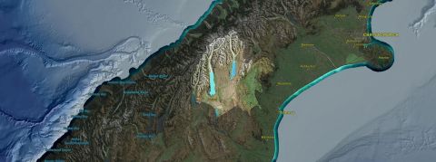
 The Canterbury Maps website provides free access to maps, records, information and data from the local government councils in the Canterbury region.
Interactive maps provide many easy-to-use ways to look at and find information resources held by the councils.
The maps can be used from any computer, touchscreen or mobile device with an internet connection, using a map viewer similar in operation to Google Maps. No special licence, subscription or software is required.
Examples include:
- Canterbury’s air and water quality, recreation and parks, planning zones, resource consents, transport links, local attractions and council services.
- Historical records, plans and aerial imagery.
- Regional plans and management information.
Mackenzie District Plan Review
Council is currently undertaking a Review of the District Plan through a series of Plan Changes. The District Plan Review Maps are not yet in Canterbury Maps and must be viewed in the EPlan.
Using the map viewer you can search for data, complete analysis, view pop-up information about particular locations / data, and download or print the maps for use in projects and reports.
Want more information? Read over the map viewer help guides or watch one of the many help videos available on the site.

Geographic Information Services (GIS) map printing
A map printing service is offered by Council.
Maps of the Mackenzie District are produced with paper sizes ranging from A0 to A4.